
By M S Nazki
Star wars: China’s Military Satellites Helped Pakistan To Attack India; Delhi Works To Bridge The ‘Big Gap’ With Beijing………..Part-III
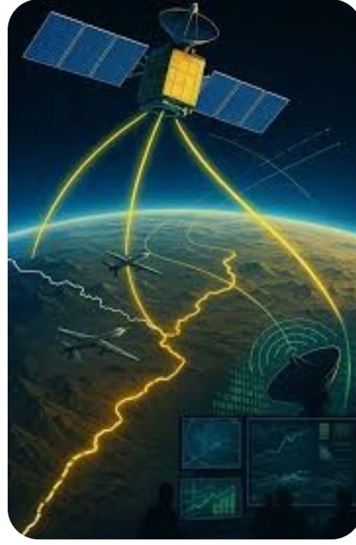
-It is no news that China supported Pakistan with military hardware during the recent military confrontation with India. However, less discussed has been the support the constellation of Chinese satellites provided in terms of Intelligence, Surveillance, and Reconnaissance (ISR) to Islamabad, and how New Delhi countered it by mobilizing all its military and civilian assets in space.
-The Indian military is taking incremental steps to build its own constellation of 52 satellites over the next five years, aiming to enhance its capability to spy from space.
-However, the ambitious plan hit a speed bump as the attempt to position the NVS-02 satellite in its intended orbit was not achieved due to a failure in the satellite’s onboard thrusters.
-Launched on January 29, 2025, aboard the GSLV-Mk 2 rocket, this mission marked ISRO’s 100th launch from the Sriharikota spaceport.
-The satellite is a crucial component of India’s Navigation with Indian Constellation (NavIC) system, which aims to provide accurate positioning services across India and extend up to 1500 km beyond its borders.
-In fact, the purported “kill chain” achieved by Pakistan with the help of Chinese space assets has been cited as the reason behind the alleged downing of India’s fighter jets. An official conceded that China is far ahead when it comes to space assets.
-“They have 4-5 times more assets than us. The Chinese have 7 geo-stationary satellites. They are able to see all the time. But the resolution is lower. They are critical for their maritime security,” the official added.
-China’s space architecture includes multiple layers of infrastructure, ranging from low-Earth orbit satellites to ground control stations, all of which are interconnected to form a resilient network.
-The Chinese can see all the time, but their satellites have limitations of bandwidth, duty cycle, and orbit configuration. However, despite its space assets, China was unable to help Pakistan pinpoint key Indian assets, such as the S-400 Long Range Surface-to-Air Missile System.
-According to comprehensive databases, such as the one published by Keep Track, China is associated with approximately 5,330 satellites in orbit. The United States leads with about 11,655 satellites, and Russia follows with around 7,187 satellites.
-Here, satellites include objects launched for commercial, scientific, military, and joint international purposes—even if they involve non-government actors—and sometimes even defunct spacecraft that are still tracked in orbit. In comparison, India has 218 satellites.
-It is challenging to pinpoint precise details about the military reconnaissance satellites China operates; however, open-source information suggests that China has approximately 30 to 40 active reconnaissance satellites.
-Most of these are from the Yaogan series, specifically designed to provide imaging and other forms of signals intelligence for China’s military. As many satellites have dual use and certain assets are kept secret by the Chinese government, the total number of military satellites could be higher.
-The Yaogan series— including the launch of Yaogan-41 indicates a continuing expansion in capability and numbers for China.
-The remote sensing satellite Yaogan-41 was launched into geostationary orbit (GEO) on December 15, 2023. The satellite is expected to allow continuous surveillance of the Pacific and Indian Oceans, as well as Taiwan and Mainland China.
-According to the Chinese government, Yaogan-41 is a civilian high-altitude optical remote-sensing satellite intended for crop yield estimation, environmental management, weather forecasting, and disaster prevention.
However, Western analysts observe that alongside other Chinese surveillance satellites, Yaogan-41 purportedly gives China an unprecedented ability to identify and track objects as small as cars throughout the entire Indo-Pacific region, putting the US and other countries’ naval and air forces in the region at risk.
The majority of surveillance satellites operate in Low Earth Orbit, as it is easier and cheaper to put satellites into LEO. Also, satellites in LEO produce sharper resolution as it is closer to Earth. However, the major drawback of LEO satellites is a lack of continuity, which is important for surveillance.
A satellite in LEO takes less than two hours to orbit the Earth. So, it can only oversee a given spot on Earth for a few minutes. Also, due to orbital mechanics, it may take hours or days for that satellite to revisit the same spot again. However, a constellation of satellites in Low Earth Orbit (LEO) can help reduce the revisit time.
On the other hand, satellites in GEO orbit are at the same rate as the Earth. This means that they view the Earth as if it is stationary. Only GEO provides a satellite, like Yaogan-41, with a continuous view of the same place. An added advantage is that a GEO satellite from its altitude of 36,000 km can see almost half of Earth’s surface.
The Yaogan satellites also play a crucial role in supporting China’s missile forces, providing the data needed for accurate targeting of long-range ballistic and cruise missiles.
There are several geosynchronous satellites, but they are primarily dedicated to weather forecasting and utilize low-resolution remote sensing systems for tracking large cloud formations and storms. Only China and India operate high-resolution optical GEO satellites; however, India’s system features a multi-spectral payload, unlike its Chinese counterparts, which carry a visible light optical imager.
India had woken up to the strategic importance of space assets in warfare during the Kargil War when the US’s denial of GPS left its soldiers high and dry as they were trying to push the Pakistani insurgents from their entrenched positions. However, work has been going at a snail’s pace.
“It has been only in the last couple of years that India has awakened to the military implications of space, and the Indian armed forces have started claiming ownership of it. IAF has realized the utilisation of Kautilaya (an indigenously developed Electronic Intelligence system),”
India established the Defense Space Agency in 2019, which is slated to evolve into a fully fledged Space Command. The IAF has envisioned India having over 100 military satellites, both large and small, within the next seven to eight years, with active participation from the private sector.
To keep pace with global developments, the IAF is gradually expanding its mission scope from offensive and defensive counter-air operations to operations in the space domain. As part of this transition, the existing Integrated Air Command and Control System (IACCS) will evolve into the Integrated Air and Space Command and Control System (IASCCS).
The government, on its part, has been shortening the launch time for military satellites. The DRDO’s project Kautilya added to India’s space surveillance capability.
The 436-kg satellite, placed in a 749-km orbit, helps the Indian armed forces pinpoint the location of enemy radars by detecting the electromagnetic signals they emit. In the making for about eight years, it carries instrumentation capable of detecting, locating, and characterising electromagnetic signals, specifically of military radars.
India’s premier intelligence-gathering satellite, EMISAT, has taken a good look at the positions of the Chinese People’s Liberation Army (PLA) in occupied Tibet.
India also has an ELINT satellite, launched in 2019, which underscored its usefulness by passing over the PLA position in Tibet near Arunachal Pradesh. The Indian Space Research Organisation (ISRO) has launched 29 satellites, including EMISAT, from the US, Lithuania, Spain, and Switzerland. This was the first time the Indian space agency launched these satellites in three different orbits.
The launch of the electronic spy satellite was a significant achievement for India; China has already been using ELINT satellites in triplets, as a single satellite will not be enough to pinpoint a target.
There is much more to it as far as space wars go! But we will soon come to terms with the same! but knowing our potential we can do it!


